 Polski
 Cesky
Cesky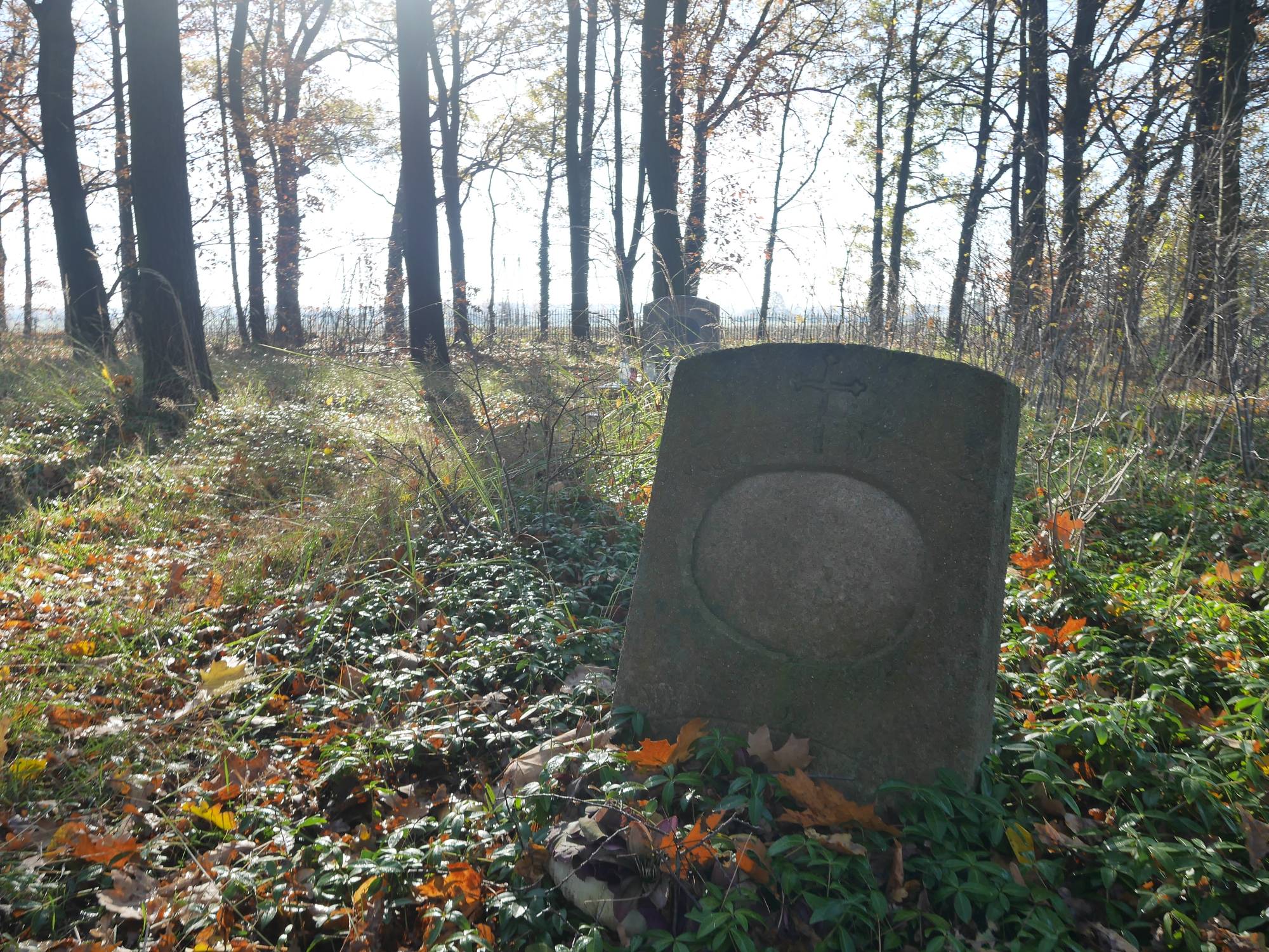
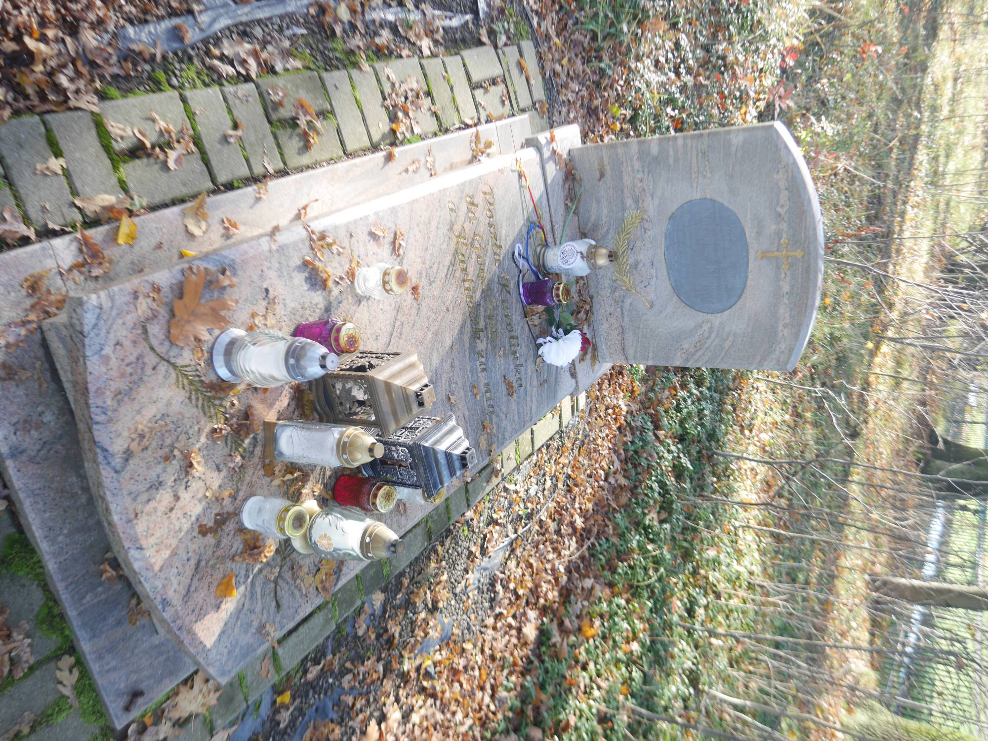
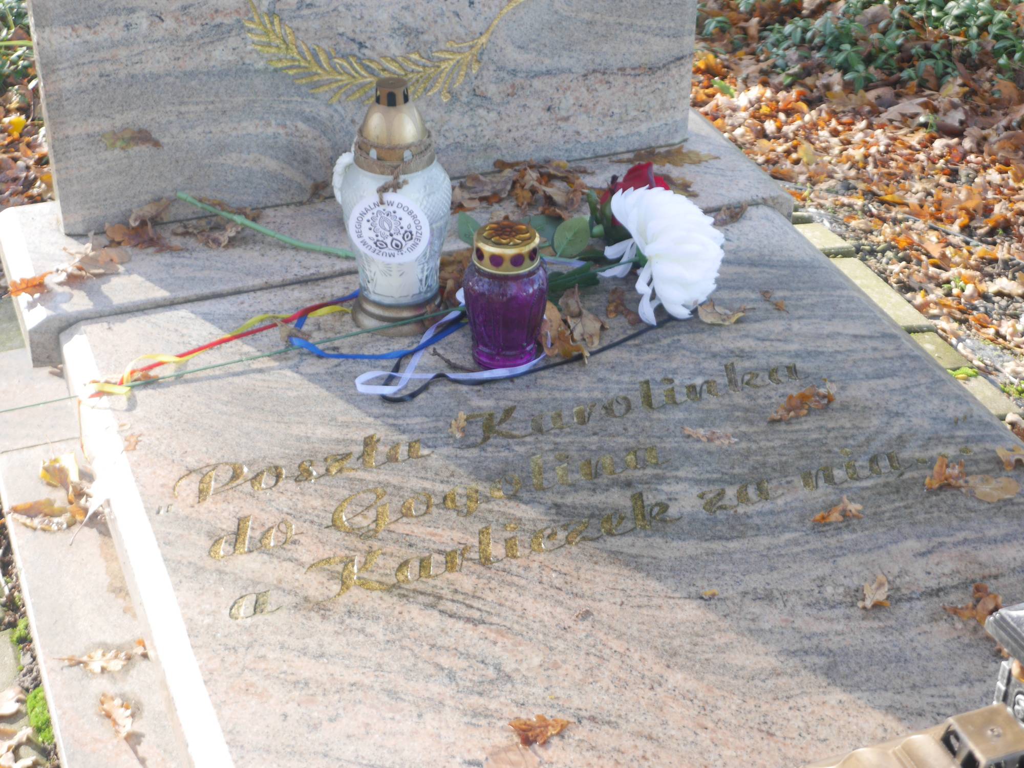
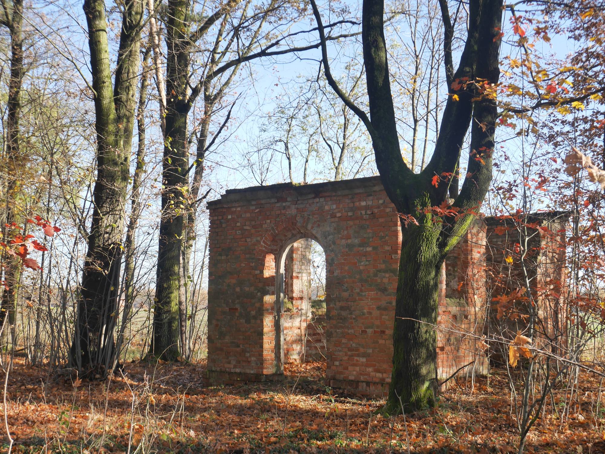
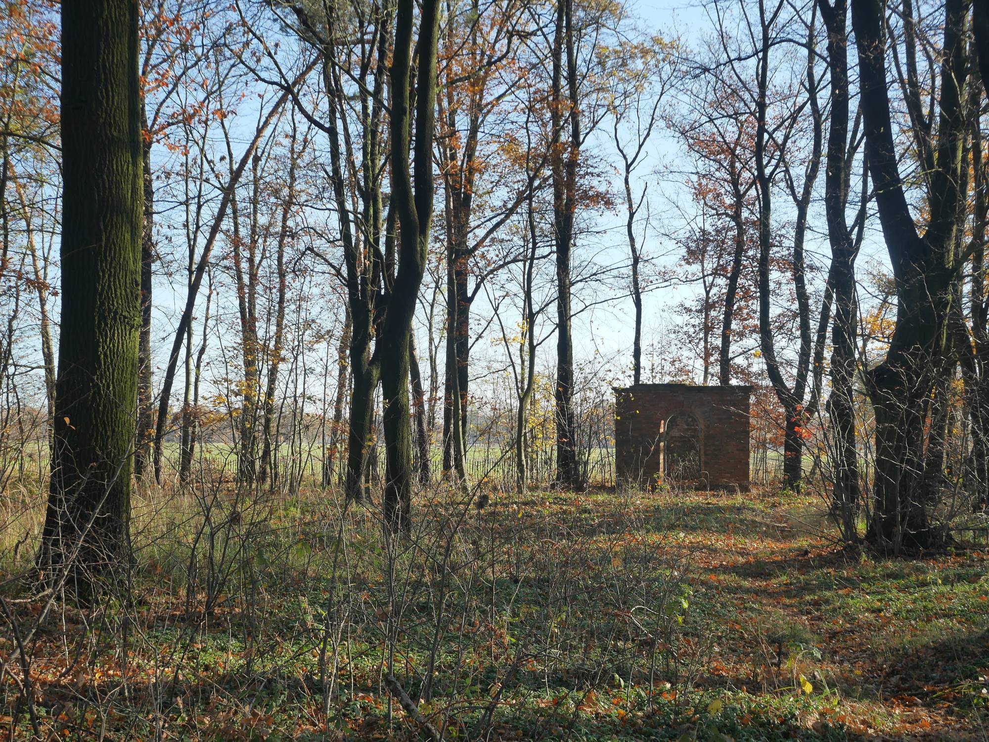
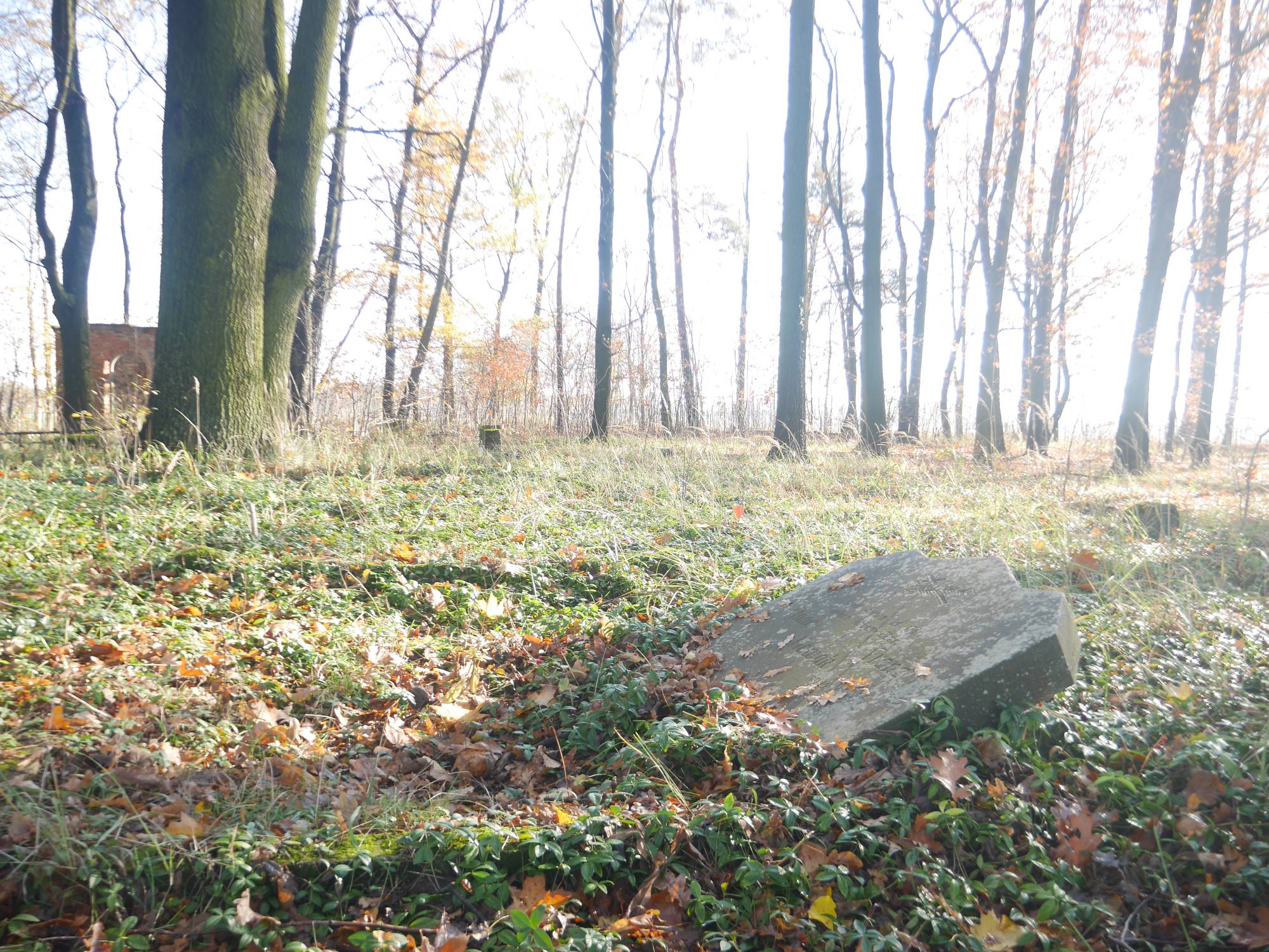
This cemetery was founded at the beginning of the 20th century by a group of colonists from Grodziec [Friedrichsgrätz]. They were Sudeten Czechs, Protestants of German origin and descendants of the Hussites (hence descriptions sometimes referring to the cemetery as "Hussite"). In 1904, they purchased land near present-day Bzinica, in a wooded area, and began building a settlement. In honor of Emperor Wilhelm II, the place was named Wilhelmshort. Soon, 358 people settled here, and the village became an independent municipality. Their religious support came from the Evangelical parish in Dobrodzień [Guttentag]. Since 1945, the cemetery has remained closed to burials and, in subsequent years, fell into systematic ruin. To this day, several tombstones have survived, including the renovated grave of Karolina Kleinert – the heroine of a famous Silesian folk song. The famous "Karolinka" who "went to Gogolinka" [szła do Gogolinka] was a real figure. She was born in 1884 in Grodziec [Friedrichsgrätz] near Dobrodzień, into a family of Czech Evangelicals. As she grew up, she was distinguished by her beauty. She caught the attention of Fryderyk Karliczek, a married man 18 years her senior. Karolina, however, firmly rejected his advances. She soon married Józef Kraiczi, with whom she had eleven children. Later, the family changed their surname to Kleinert. They lived in Bzinica Nowa (Wilhelmshort). On June 13, 1939, Karolina was returning from the fields in a horse-drawn cart. At that time, her neighbor, Czampel, was waiting at home for the return of his wife, who was intending to go to Berlin without his consent. When he heard the approaching wagon, he walked out with a weapon in hand and shot Karolina. The perpetrator, realizing the tragedy he had caused, committed suicide. Today, her grave is a symbol of memory for the former inhabitants of Wilhelmshort and their destinies.