 Polski
 Cesky
Cesky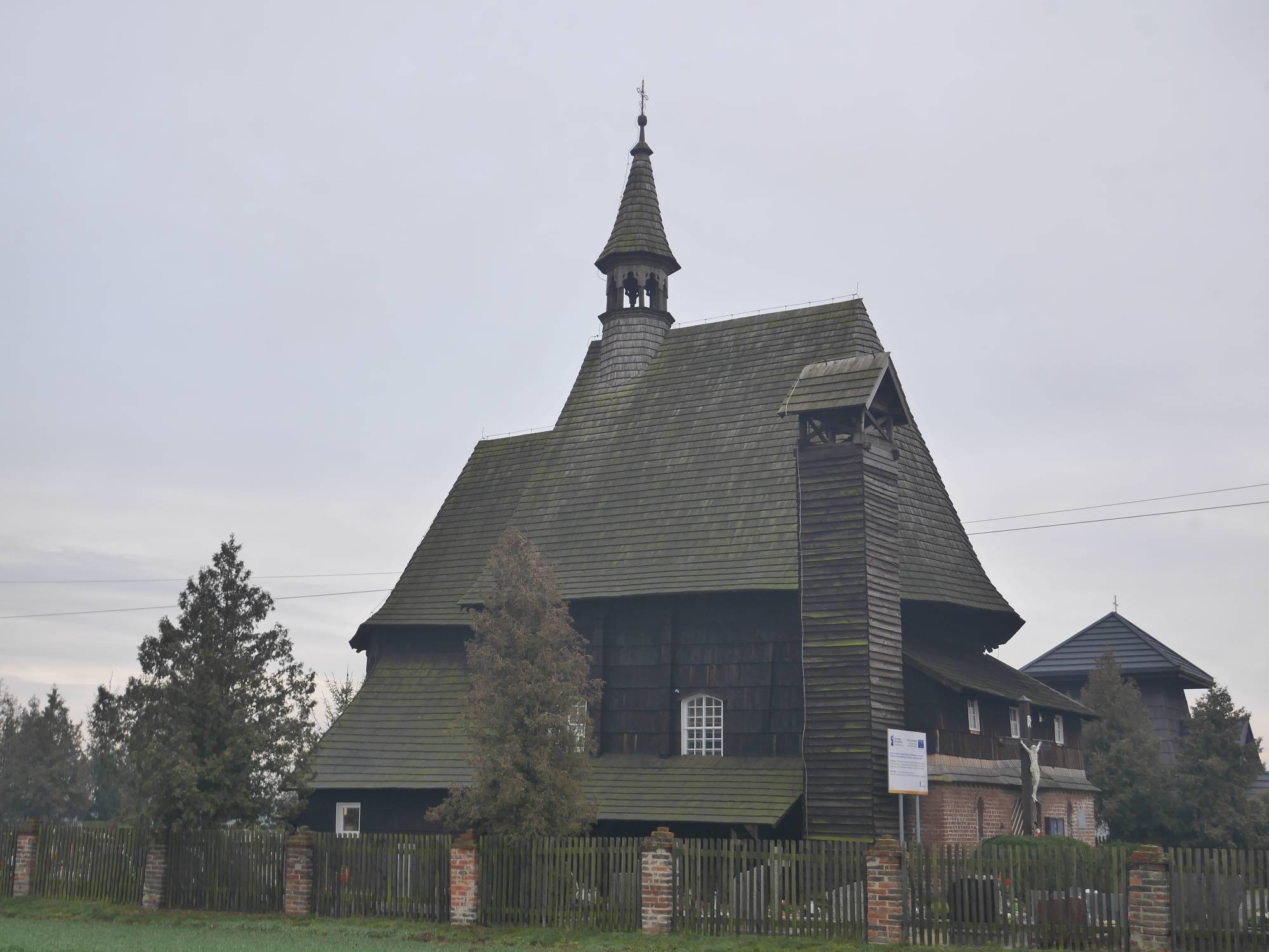
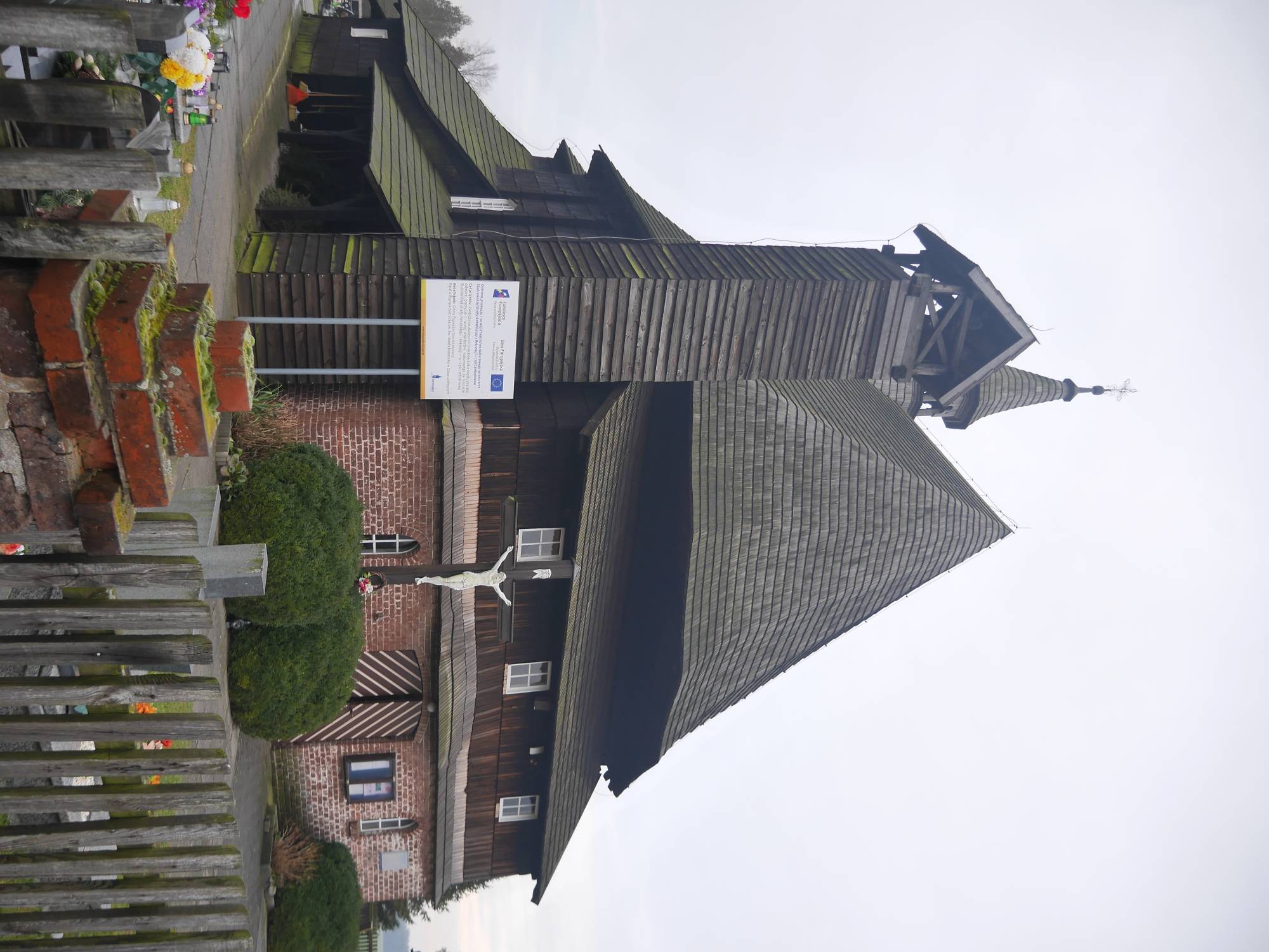
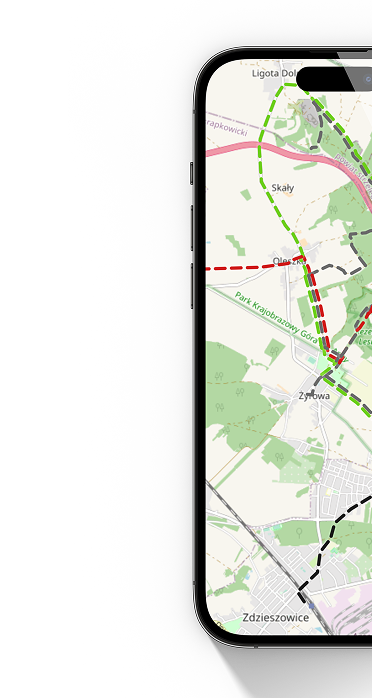
The wooden church of St. Barbara in Kolanowice is one of the more valuable sacred monuments of the Opole region, and its history is exceptionally unusual. The temple was built in 1678 in Opole as a Bernardine convent church. After the suppression of the order in 1810, it was put up for sale, and the residents of Kolanowice decided to purchase it and move it to their village. The dismantling, transport and reconstruction took over a year, and finally the church was consecrated at its new location in 1812. Around the middle of the 19th century, a brick porch was added to the church from the west. In the 1970s, a bell tower was built next to the church.
The structure is made of log construction, with a square nave, a smaller chancel closed tribonally and a sacristy. The whole is covered with a shake roof, and above the nave rises an octagonal bell tower with a spire helm. The characteristic posts surrounding the church give it a picturesque, typical Silesian appearance. The interior houses valuable Baroque furnishings: three altars from the 17th-18th centuries, a pulpit and numerous paintings. A special decoration is the choir railing, covered with a cycle of twelve scenes from the life of St. Barbara. Church pews from the 18th century and a confessional have also been preserved.
The church has been renovated several times, but has preserved its original character. As a filial parish of Osowiec-Wegry, it today serves a sacred function and is an important stop on the Wooden Sacred Architecture Trail. Its history and architecture make it one of the most beautiful wooden churches in the region.